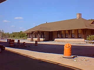
Train Station
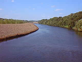
To the left under Route 8, the present train station and office of Valley Regional Planning Agency are located in a shingle-style building constructed in 1902. This east end of Main Street has remained an important transport locus of bridges and roads linking New Haven and the Valley. The first train station was just to the west, and a trolley barn was located on the right across Main Street. Nearby can be seen railroad tracks and the flood wall built to contain the Naugatuck River after the Flood of 1955. As you pass over the bridge on your way to "East Derby" and the old "Uptown" section of Derby, pause and look to your right where the Naugatuck and Housatonic rivers merge. Though there are no historical remnants remaining, Derby was once an important ship building center with a thriving trade with the Carolinas and beyond. Construction of roads to New Haven and Bridgeport eventually doomed Derby's early position as a maritime center as inland farmers eventually bypassed Derby on their way to the deeper ports that were open year round. Turn left when you reach the end of the bridge in front of St. Michael's Church. |
|
||
|
|||