Business Community
City Hall
Civic Groups
Community Calendar
Education
Emergency Services
History
Library
Municipal Services
News
Places of Worship
Photographs
Sports & Leisure
Search
Site Map
Home
| MAPS |
|
|
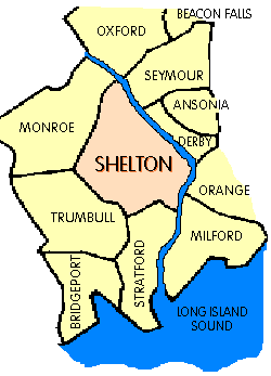
It's located on the northeast edge of Fairfield County and bordered by the
communities of Derby, Milford, Monroe, Orange, Oxford, Seymour, Stratford, and Trumbull. |
|
|
|
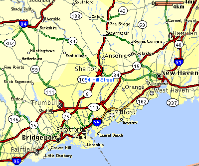
Shelton is served by Route 8, which has arterial connections to Interstate 95 and the
Merritt Parkway (Route 15). This makes for easy access to New Haven, Bridgeport (10 miles), Stamford
(30 miles) and New York City (60 miles). |
|
|
Detailed online maps from:
Yahoo Maps || Mapquest
|| Topozone